Lori Carey Photography

Wednesday, April 30, 2008

Northwestern Mojave - Last Chance Canyon, Sheep Springs, Burro Schmidt Tunnel and Nightmare Gulch

Wow, what a fantastic weekend we had running with the Project-JK folks through the neopolitan ice cream colored hills of Red Rock Canyon State Park and the El Paso Mountains Wilderness in the northern Mojave desert. This area gets a 10 for the wheeling, a 10+ for the scenery, and a 10 for the cultural sites. The colorful landscape of Red Rock Canyon State Park has been the location of many films and commercials, including Jurassic Park. This is definitely a place that rates a return visit (or several) when I can take my time to do more exploring and really concentrate on the photography. Oh yeah, and the weekend definitely rated off the charts for the camaraderie.

El Paso Mountains Wilderness

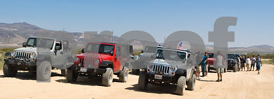
When WoL posted up the trip as a newbie run (to get new jeep owners familiar with their jeeps and offroad procedures, techniques, etc.), a whole bunch of not-so-newbies signed up for the trip because this is such a great location and we ended up with 25 (maybe 26?) vehicles all together (we even had a TJ and an H3 join us). We split into two groups, with Trailbud leading the experienced wheelers in Group 1 and WoL leading the OffRoad 101 group. Since I was running with Group 1, I photographed our wheeling while the WoL team was back with the other group.

NotMySonsJK climbing out of the wash in Last Chance Canyon


The Last Chance Canyon trail starts in Red Rock Canyon State Park off Randsburg-Red Rock Road. Massey and Wilson rates it a 5 for difficulty because the formed trail rides alongside the river wash. To increase the difficulty you can ride in the wash and tackle rocky sections that require strategic wheel placement to avoid underbody damage and a little ledge climb. Of course this was the route we took. The steepest section of the trail can't be avoided; it's a low-traction climb out of the wash that earns the trail the 5 rating. There is a choice of choosing to climb on rocky dirt with better traction or smooth-faced rock that requires good tires. Guess which one we took?

Riding along in Group 1 we had Trailbud leading the way, FunN4Lo, NotMySonsJK, serveapurpose, Lensman, his friend Joe in the H3, MrBash, artpics and jkpirate. We started the trail ready for adventure while WayOfLife conducted a basics class for Group 2. I missed shooting the first obstacle, a little ledge climb because I was concentrating on my wheeling, but since I was near the front of the line I made sure to shoot on the next big obstacle and even let Bill take the wheel for one so I could shoot him.

Here's Trailbud climbing out of the wash:
Trailbud climbing out of the wash in Last Chance Canyon

FunN4Lo:
FunN4Lo climbing out of the wash in Last Chance Canyon

and Lensman:


serveapurpose navigating a rocky section:
serveapurpose navigating a rocky section in Last Chance Canyon

MrBash having a little fun:
serveapurpose having a little fun in Last Chance Canyon

artpics putting his stock Rubi to the test:
artpics putting his stock Rubi to the test in Last Chance Canyon

jk pirate in the rock garden:
jkpirate in the rock garden at Last Chance Canyon

and NotMySonsJK watching his son at the wheel in the rock garden:


I've got to hand it to Joe; we gave him a lot of abuse about his H3 and he was a really good sport about it. We gave him even more abuse when he got hung up on the rocks a few minutes into the trail and we had to strap him out. He was still laughing and having fun when he got hung up again and the guys really let the abuse fly while strapping him off the rocks. Street tires are not a good choice for this trail unless you remain on the formed trail.


We reached a section that was marked closed, and not sure of which way to go we started heading down a trail that appeared to parallel the Last Chance Canyon trail to try to get WayOfLife on the CB. We had planned to wait for Group 2 before making the steep climb out of the canyon anway, so we found a spot that was bordered by beautiful pink cliffs where some of us stopped for us lunch while Trailbud tried to get WoL on the CB and FunN4Lo and serveapurpose went off to investigate another trail.


When Trailbud determined that Group 2 was at least an hour behind us and FunN4Lo told us they found an incredible overlook, the rest of Group 1 decided to ride up to the top. Wow, what a view (it's the first pic in this post; the elevation was 3800 feet and there was a nice cool breeze blowing. We found a mine shaft and a little ways down below was an old cabin. This area is filled with old mines and mining camps, including the "Old Dutch Cleanser", the Cudahy Camp and the Bickel Camp.

After enjoying the view and the breeze for a while we finally heard Group 2 on our CBs and headed back down to the wash to meet up with them. WayOfLife showed us where we missed the turn for the climb out of the canyon (oops!) and all 25 vehicles lined up in preparation to make the climb. Trailbud and I went up to the front of the line to (unsuccessfully) try to convince WayOfLife to let Group 1 in the front of the line, and as we were walking back to our jeeps someone asked me where my jeep was. Would you believe that Bill jumped in my jeep and took off into the wash to try to worm his way up front?! I think he was jealous that I was having all the fun again, but there I was with no jeep and the group driving off. I jumped into Trailbud's passenger seat, but my camera was still back in my jeep. The climb up that rock was really cool and I'm mad that I didn't get any photos of it, but at least Bill had a few minutes of fun even though he still got stuck in the back of the line (hehe).

Everyone did a great job with the climb, even the newbies with the stock jeeps took the hard line and I'll bet it really increased their confidence level with their jeeps. Once everyone was at the top Group 2 needed to stop for lunch and Group 1 was too hot to sit in the sun and wait, so we took off "supposedly" to head out toward Sheep Spring where many of us were camping for the night. I say supposedly because no one really knew where they were going. I won't name any names as to who was leading the group at what point in time, but we had a great time riding all of the different trails in the area! At one point we found ourselves at the 14, so we aired up the people who weren't spending the night while we tried to figure out which trail to take next. We were out having a great time and doing a lot of wheeling, and we weren't in any danger of being seriously lost, so I was having fun.

"Who's got the map?"
Who's got the map?

One surprising thing I noted is that while the wildflower bloom is almost over in most of the location's we've been, it seemed to be just getting started out here, even at the lower elevations. The joshua trees were just getting ready to bloom, and there were specimens of several different flowers at their peak or even still just budding. I haven't processed most of those shots yet, but here's a Mojave Aster I found at our "Top of the World" location:

Mojave Aster

We eventually figured it out and found our way to the campsite at Sheep Springs. We were hot, tired and dirty, but when Team Jasoncliff handed me a frozen margarita I was in heaven! Yes, they actually had a frozen drink maker hooked up to their jeep battery, I never did think to ask how they managed to carry/make enough ice to serve frozen margaritas to the entire crowd all night long. Wow, that was absolutely the best treat at the end of a hot desert day.

Things only got better as MrBash and his uncle started cooking up Armenian barbecue for everyone. OMG it was soooo incredibly good. The party was in full swing! It was a great time with old friends and new. Sticking around to camp for the night was the WayOfLifes, FunN4Lo, NotMySonsJK and his son Bobby (Fun's brother), MrBash and his uncle, Toad and BullFrog, TeamMazzman, JKPirate, jasoncliff and family, and Trailbud. JKTyrant and a buddy drove up that evening and joined us too. It was a long hot and since most of us had been up since 4am, after gorging ourselves on MrBash's barbecue, frozen margaritas, and of course the usual bottle of Jamesons, most of us went to our tents pretty early. By the way Trailbud, Bill said you passed his bottle around and didn't save any for him!

I was up before the sun and stumbling around in the dark trying to be quiet so I didn't wake anyone up, but I don't think I was successful. There were large rocks between me and my jeep and I kept tripping over them - I'm not very coordinated before my coffee. Got the fire going and put coffee on. Pre-sunup is always my favorite time in camp; a few minutes of peace watching the world coming alive again. We were surrounded by hills so I didn't get any good sunrise light once again. JKPirate was up shortly after I was, and then Trailbud who is another early riser. Everyone was excited about another day wheeling, so the rest of the group was soon awake and cooking breakfast, and we were packed up in record time. PoorDad had planned to ride up to meet us in the morning so he could do the trails with us, and we had some time to kill before he showed up. JKPirate had told me that there were petroglyphs on the hill behind our campsite so most of us took a walk to check them out.

Sheep Springs is historic Kawaiisu indian territory; it was an important water location for the indians and still is for the desert bighorn sheep. Most of the petroglyphs are Great Basin curvilinear or rectilinear shapes which are difficult to interpret because the elements may have meaning only known to the shaman who created it. The El Paso mountains are also the southern limit of the Coso Style bighorn sheep petroglyphs, which have boat-shaped bodies, skinny legs, and horns extending to the sides. On the hill behind the stream there are hundreds of petroglyphs carved into the rocks.

Kawaiisu petroglyph at Sheep Springs in the El Paso Mountains, California

I wish I had researched this location before we spent the night so I knew a little more about the petroglyphs beforehand. I can recognize a water glyph, and the sheep are usually pretty easy to recognize, but there are a lot of petroglyphs here that seem to be entopic image, created by the optic nerve of a shaman as he entered into a trance-like state as part of his vision quest.

On this one I can clearly make out three teepees at the bottom:

Kawaiisu petroglyph at Sheep Springs in the El Paso Mountains, California

We thought that may have been because this was the perfect spot for the indians to stay - it was high flat ground with a 360 degree view of the surrounding area and running water.

The view from the top of the hill at Sheep Springs in the El Paso Mountains

Kawaiisu petroglyph at Sheep Springs in the El Paso Mountains, California

Water glyphs point the way to the nearest water location(s). Usually once the water source is located, there will be more glyphs pointing toward other water locations. I found several water glyphs at this site.

There's a water glyph on the rear rock in this photo:

Kawaiisu petroglyph at Sheep Springs in the El Paso Mountains, California

and several included on the petroglyphs on this photo:

Kawaiisu petroglyph at Sheep Springs in the El Paso Mountains, California"

There are several grinding stations or milling sites at this location also.

A grinding or milling station at the Kawaiisu indian petroglyph site at Sheep Springs in the El Paso Mountains, California


Around ten PoorDad radioed in that he had missed a turn but was less than a mile from camp so we head out to meet up with him and make our way to the Burro Schmidt Tunnel.
Talk about a man on a mission, this guy decided to create his own shortcut through the mountains by hand-digging a half-mile long tunnel through the solid rock of Copper Mountain! It took him 38 years to complete the tunnel, and when it was finished he realized that it exited at a point too high and steep on the other side, and that there wasn't a way to get down to the valley. Poor But all was not lost; along the way he took out 20 tons of ore averaging $60 a ton in gold, silver, copper, iron, molydenum and tungsten.

Flashlights in hand we walked through the low-ceiling tunnel and enjoyed the incredible view on the other side.

Entering the Burro Schmidt tunnel

From there we moved on to Nightmare Gulch. Nightmare Gulch is seasonally closed or restricted for raptor species sustainability, but fortunately the trail was open and we got to enjoy the magnificent views. Bill decided that this was his to day wheel since I had all of the fun yesterday. It seemed even hotter Sunday than it had been the day before, and we all realized that this would be our last desert run for the season. It's a relatively easy trail, until WayOfLife decided to take a detour to a scenic overlook that took us down a long slick granite dome. I was glad Bill was at the wheel because those long steep hills just freak me out. I mean, it was really steep! I don't know why I have such an issue with it, I think it's the vertigo combined with a fear of rolling. I wish I took photos but I was too busy hyperventilating.

It was worth it for the view we got overlooking the pink, white and brown striped hills:


Then I found out that we had to drive back up the impossibly steep granite dome to get back to the main trail! It always amazes me how well my jeep performs on stuff like this, and I hope that I get over my fear of height and rolling to be able to conquer a climb like this myself. For now, Bill handles it like a champ so I don't mind letting him take the wheel.

There's an old talc mine we stopped to explore, but the shaft was closed off and we didn't find another way in. I didn't realize that this area was once ripe with petrified forest. Next time I'll know to look for the petrified wood, although collecting is prohibited. I have a really cool piece about 8 inches long and 2 inches wide that I discovered when I was diving a few years ago.

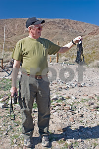
We exited back on Randsburg-Red Rock Road, aired up our tires and drove to the Jawbone Canyon staging area to dump our trash. From there it was bumper to bumper traffic most of time as we made our way back home.

There are lots more photos in the gallery on my website here, and MrBash put together a cool YouTube video. Thanks for allowing me to post it MrBash.


My jeep is the silver one with the PIAA lights.

Our trips for the next few months will be up in the Sierras and Big Bear.

Thursday, April 24, 2008

Uninvited Guests

Tony Soprano and ducks in my pool

When I looked out the window and saw a pair of ducks casually swimming in my pool, all I could think of was Tony Soprano.

Nothing after the jump.

Wednesday, April 23, 2008

Adobe revises Photoshop Express TOS, but there's still a big problem here...

The blogosphere was up in arms over Adobe's initial TOS (Terms of Service) for the much-anticipated Photoshop Express beta launch last month, as I original posted here.
Adobe responded to concerns almost immediately and revised the TOS effective April 10 to use wording that gives Adobe much more realistic rights as concerns user submitted material. I think it is a tribute to the power of "the internets" that we can band together so quickly and unite our voices to make things happen. Wow, talk about strength in numbers.

But they made another change at the same time that few people seemed to have noticed.

It seems that when the lawyers revised the paragraph(s) pertaining to Adobe's rights concerning your photos, they also added a few paragraphs that gives a license to other users to legally use the photographs you make public by sharing your content.

The new paragraph 6.b. reads as follows:

By Other Users

You hereby grant Other Users a worldwide (because the internet is global), royalty-free (meaning that Other Users do not owe you any money), nonexclusive (meaning you are free to license Your Content to others) license to view, download, print, distribute, publicly perform and publicly display Your Shared Content subject to the limitations in Section 7. If you do not wish to grant these rights in Your Shared Content then do not share Your Content with Other Users. While you have the ability to remove Your Content from the service and/or the public areas within the Service and thus prevent future licenses from being granted, you acknowledge and agree that once Your Shared Content has been shared, Adobe can neither monitor nor control what Other Users do with it.


The Section 7 limitations noted in this paragraph refer to the license that Adobe gives to users to use/print/publish your photos:

7. Use of Shared Content

Section 5 (a) of the General Terms shall continue to apply to Adobe Materials. With respect to User Content, however, Section 5 (a) of the General Terms is hereby replaced with the following:


Adobe grants you a worldwide, royalty-free, nonexclusive license to view, download, print, distribute, publicly perform and publicly display content shared by Other Users with you via the Service or that Other Users make publicly available via the Service (“Shared Content”), subject to the following conditions:

1. Your rights granted by this Section are limited to your personal, informational, non-commercial and, in the case of a business, internal purposes only;
2. You may not sell, rent, lease or license the Shared Content to others;
3. You may not modify or alter the Shared Content;
4. You may not remove any text, copyright or other proprietary notices contained in the Shared Content; and
5. When you embed Shared Content on a web page, you agree that you will include a prominent link back to the Service from that page.


It's my guess that Adobe realizes that theft of images is rampant on the internet and is just trying to avoid getting caught in the middle of a lawsuit, but this is something that users really need to think about. What, you think just because you're not a pro that no one will want your photos, or that they're not worth any money? Maybe you never heard about the Virgin Mobile fiasco when they used Flickr photos for an ad campaign that had a Creative Commons license (which allowed for commercial use as long the photographer was attributed) which really were just snapshots of friends. Unfortunately Virgin Mobil neglected to obtain a model release for a minor depicted in one of the photos. How about Stephen Baker, who used a photo posted on another website to win a cash prize in a Fujifilm photo competition. Even though he was caught, the guy had the nerve to do it again. And thankfully was caught again. Ask the amateur photographers on Flikr if there's a problem with people stealing their photos.

Yes, theft of images is out of control on the internet, but at least if you retain your copyright (your photo is copyrighted the moment you activate the shutter, whether or not you register it) and control how your images are licensed, you have a legal basis for taking action. My problem with Photoshop Express' TOS is that, for example, another user could take a photo of your 6-year-old niece that you uploaded to a public album and post it on their personal website in an inappropriate manner, and there would be nothing you could do about it because you gave them a license to do so as long as it complied with the conditions outlined in paragraph 7. Do you really want to lose control over how and where your family photographs are used?

What bothers me most about the whole thing is that the people most likely to use Photoshop Express are the people least likely to know anything about intellectual property rights and laws. The fine details of copyright law are way beyond the scope of this post and my level of expertise (ha, even attorneys/experts/courts frequently appear confused), but I strongly encourage anyone who posts photos on the web (your own or those of others) to familiarize themselves with the Digital Millennium Copyright Act of 1998, both to make sure that your rights aren't violated and that you aren't violating anyone else's rights and therefor subjecting yourself to legal action.

As for Photoshop Express, if you decide to use it make sure you read the TOS before making your galleries public. Then read the TOS at other photo sharing sites. I looked at nine of the top sharing sites and all but one specifically protect your copyright. Only Kodak's EasyShare gallery permits other users to print your photos and place them in their own galleries. But even they don't give other users a license to pretty much use your photos however they wish.

Why aren't more people talking about this issue? To be fair, when Adobe revised their TOS they sent out a press release to the heavy hitters detailing the change. I'm sure most people looked at the revised wording and gave it their blessing. People are busy - How many would actually go back to the website and read through the entire TOS yet again to see if any other changes were made?

Anyway, be informed, read it for yourself, read the TOS at other photo sharing sites, and make your own decision over what level of control you want over your photographs.


Tuesday, April 15, 2008

Not all sweetness and light...

Lest anyone think I've gone soft in my old age and am now concentrating on photographing flowers and rainbows -

The haunted KEA Milling building in Murrieta, California.

That's the KEA Milling grain elevator in Murrieta, California. I just happened upon it while looking for another building I remembered seeing in the area. Did a little research when I got back home and found out that it is supposedly haunted by a young girl in a blue dress. I took several shots from different angles, then just as I had picked up my gear to head back to the jeep I saw two crows fly out of the top window. Had just enough time to grab two shots before they were out of the frame. With the storm clouds in the back it gave it exactly the atmosphere I was looking for.

Nothing after the jump.

And here is the rest of it.

Sunday, April 13, 2008

Chasing Rainbows

I like participating in dGrin's weekly assignments because they get me thinking about creating images of things and in ways I ordinarily wouldn't. This week's assignment was to create and photograph a rainbow. This one is my favorite.

Chasing Rainbows

Nothing after the jump; I've been working on some website customization and have really made a mess of things. Now I have a headache.

Wednesday, April 9, 2008

Mojave Road Finish


Last Saturday we finally made the time to finish the section of the Mojave Road that we missed last month. Only four of the jeeps from the original group joined in, the WayOfLife family, Toad and Bullfrog, Trailbud and his son Ryan and us, but we were joined by two new jeeps and three new people; fellow photographer artpics and Dawson and his wife. Six jeeps is the perfect number for a day of exploring and adventure. WayOfLife agreed to run the trail in the opposite direction, from Afton Canyon to Soda Dry Lake, so that Toad, Bullfrog, Bill and I could spend Saturday night at Kelso Dunes.

We met for breakfast at Coco's in Barstow and had a great time meeting the new people. They fit right in to the group and we knew we were going to have great time. After a hearty meal we gassed up and heading for Afton Canyon.

It was the perfect day for a trailride and some adventure. It was warm in the sun and cool in the shade. Okay, sometimes it was a little too warm in the sun, and we could tell that this would probably be our last Mojave run for the season. Maybe not, we'll see. There's still so much more out there I want to see.

After airing down at the campground in Afton Canyon we hit the trail, running alongside the railroad tracks for a while, then making our first crossing of the Mojave River. The water was about two feet deep, enough for a little fun and some good photos. I wanted to drive through this one so I didn't shoot, thinking I would let Bill take the next river crossing and I could shoot. As it was, we ended up taking a slight detour and never got to make the second crossing.

Our first stop was at a slot canyon where we found Beavertail cactus in full bloom. I also found some tiny Mojave Desert Star, a Desert Pincushion, Goldfields and Gilia (I think either Showy or BroadFlowered). I tried to get my gear bag out of the back of the jeep so I could get my macro lens, but we were parked on a such a steep incline that it was impossible to open the swing gate. I always tell Bill when we're loading the jeep that I need two things accessible at all times; the cooler and my camera bag. He thought that meant to put it at the back of the jeep, when I meant close to the front seat. Lesson learned - put the bag in the jeep myself next time. Since I'm not really into flower photography anyway it was no big deal.

Our next stop was the incredibly cool Spooky Canyon.I had no idea what we were in for when we stopped the jeeps. WayOfLife told us to grab flashlights and we head off under a railroad bridge and into a cleft in the cliff. As we hiked further back the walls got narrower and narrower until we were walking single file and there was just a tiny slot of sky overhead, then no sky at all and it was pitch black. The trail started a steep and rocky ascent that was mostly in the dark with an occasional peak of sky. We continued to scramble our way up until "BAM!" Bill was holding our flashlight and had gone ahead to help someone up a climb, and I was two people behind him in the dark. I didn't realize that the ceiling at the top of one little climb was only two feet high and I smacked my head hard enough to see stars. Leave it to me to be the clumsy one, and least my camera wasn't damaged. It did give me a wicked headache though.

When we reached a vertical climb I decided to call it quits; just didn't have what it takes after that knock on the head. Artpics and I had our cameras around our necks and didn't want to risk damaging them (should've grabbed the backpacks!), so he and I along with Dawson and his wife headed back out while the rest of the group ventured on. Further back there are two climbs that are so steep that you need to use the ropes that are hanging in place. The kids were the only ones to brave the second rope climb and make it all the way to the top.

After some much needed cold drinks we rejoined Mojave Road and continued until we reached the spectacular railroad bridge over the Mojave River. With the jeeps parked in the shade under the bridge, Cindy and I ran up top with our cameras, soon joined by WayOfLife. Built in 1936, the steel geometry of the bridge is in stark contrast to its desert surroundings. The shade of the bridge provided a relaxing spot for lunch so we kicked back for a while just enjoyed the day and the company.

But soon enough it was time to hit the trail again so we could reach the dunes before sunset. The trail through here is mostly deep sand, what Casebier's guide refers to as blow sand. We were close to Soda Dry Lake when WayOfLife decided to explore a side trail that he had never been on before, and that ended up being the best stop of the day. We traveled to the top of a hill and found two old abandoned cabins, then an incredibly huge mine shaft. What we didn't realize at the time was that this was the Brannigan gold mine, later known as Oro Fino. The cabins still had old belongings inside -a jacket, some pantry items, comics and a calendar on the wall. The grounds were littered with old barrels, cans, vehicles and parts, machinery, you name it. I found some Desert Five-Spot, Apricot Mallow (Desert Globemallow) and Desert Pincushon. A little further up the hill we found the most incredible mine shaft. This was the real deal, complete with rail tracks running down the main shaft. It looked extremely stable (much better than a lot we've been in) so out came the flashlights and in we went to explore. We could go waaay back in this one until we reached some vertical shafts. This would be a great place to camp and do some light painting, but it would be a little on the spooky side. The Lost Arch Inn didn't spook me at all, but I think this place would.

We later found out that one of our friends knew the people who operated the mine as the Oro Fino mine, and he used to hang out there twenty years ago. He told us some great stories about the times he spent there and I can't wait to hear the rest. It's really cool to hear about the history from someone who was actually there.

Back on the trail heading toward Soda Dry Lake, we took a quick stop for a bio break and to grab some shots of Sand Verbena, Bladderpod and Silver Prickle Poppy. When we reached the edge of the dry lake bed we stopped to grab our rocks to add to the Traveler's Monument. I think one day all of the rocks in the area are going to end up in the middle of the lake!

We hadn't had rain for several weeks so the lakebed was dry except for one mushy spot. It really bothered me to see that so many people refused to stay on the trail and there were tracks all across the lake bed. I guess some people just have to try their luck with the infamous mud. The crusty surface of Soda Dry Lake is caused by alkali salts forming a coating on the bed of the playa where the groundwater table is at or just below the surface.The salts accumulate through capillary rise of salty groundwater and evaporation and return to the groundwater when it rains. The salt from Soda Dry Lake contributes to much of the windblown haze and dust that occurs in the Mojave region.

It was a straight shot to the Traveler's Monument with salt and dust flying everywhere. We added our rocks to the pile and took more photos, then we got lined up for the next segment of the video. I decided this time to let Bill take the jeep while I went down to the end with WayOfLifette and artpic to shoot the jeeps. It's always a tough decision as the whether I want to shoot or wheel! WayOfLifette wanted the jeeps to try to stay close together for the video, but between the bugs on the windshields and the dust and salt flying, it was next to impossible. I had to take a photo through my windshield when we left to show just how bad it really was. We were shooting into the sun here, but the results were better than I had expected.

Across Soda Dry Lake, we were soon on paved Kelbaker Road and racing to get to Kelso Dunes before the sun set. Once I again I was too late to hike to the top but I'm sure I'll be able to convince Bill to make another trip (although it will probably have to wait until fall). We turned onto the road to the dunes just as the sun was setting, and by the time we made it to the primitive camping area the sun had dropped below the mountains. But the most wonderful surprise was that the base of the dunes was a carpet of Dune Evening Primrose everywhere we looked.

Toad, BullFrog, Bill and I started setting up camp as the rest of the group head for home. We were ravenous and tired from all of our explorations, so as soon as the tents were up we cooked big dinners and settle in by the fire. After we had finished dinner we were joined at our fire by Will, a guy who was camping alone and looking for some company. He brought a bottle of wine and his sweet bulldog Booger (and she's a girl!). He's looking to start an expedition guide business, so we spent some time talking about the places we've all explored. When the wine was gone the whiskey came out. Toad and Bullfrog head to their tent early, and while Will and Bill talked politics (time for me to leave!), I set up my camera for the night shot I posted previously. It was around 1:30 or 2:00 before the fire died out and we called it a night.

Somehow I managed to get up before sunrise, but I really needed to make coffee before heading out. Will met up with me to hike out to the dunes, but we didn't make it further than the wash. It was hidden from the campsite and ablaze with flowers. A few of the ones I found are; Dune Evening Primrose, Brown-eyed Primrose, a yellow primrose I haven't been able to identify, Desert Canterbury Bells (California Bluebells), Desert Chicory, and a blue one I haven't identified yet. There were so many others that I didn't take photos of...and I didn't get to stop for photos of the blooming Joshua Trees. I really am not into flower photography and I don't do it well, but I guess it's become a sort of scavenger hunt to see how many I can find. It's a shame that we only get a good bloom every few years, but I guess that's part of what makes it so fun to find them.

The early morning light wasn't nearly as good as it had been back in December when we camped here and I didn't photograph the dunes at all. The angle of the sun just didn't work for me. Now there's a trade off - good light and overnight temperatures in the 20's, or bad light and overnight temperature of 50...

Heading back home and chatting over the CB, Toad and I made note of some interesting trails we spotted that headed toward some places we put on the list to explore. I hope the temperatures stay mild enough for us to fit in another trip or two in the Mojave region before we head up to the mountains.


Tuesday, April 8, 2008

Light painting my campsite

Just a quick post while I finish processing the photos from our Mojave Road wrap-up trip last weekend. Toad and Bullfrog stayed to camp with us at the Kelso Dunes. We missed sunset because we were busy exploring elsewhere, so I decided to play around with some night photography.

Lightpainting my campsite at night.


I suspended a little LED tent lantern inside the top of the tent, and the light on the ground in front of my tent is from the campfire. It's partially blocked by Toad's jeep which created some nice shadows that look almost like a path leading up to the tent. The last time I tried this I only had the light on for five minutes and it wasn't nearly enough light so I knew I needed to leave it on much longer this time. Unfortunately I didn't take a watch with me, so I just had to guess, and I think it was close to half an hour. It's a little too hot, especially at the top of the tent, so next time I'm going to move the light closer to the middle of the tent and keep it around 20 minutes (and remember to bring a watch).

It was a dark moonless night; there should've been a baby new moon out there somewhere, but I don't think it ever made it over the mountains. It was so dark that I coudn't even see if I had a good composition and I just set focus at the hyperfocal distance. Another note to self that I need to get a much more powerful flashlight for night photography. The ones I have are fine for poking around in caves or navigating the terrain in the dark, but not nearly bright enough to light distant objects sufficiently to allow sharp focusing.

I also just realized that my 20D EXIF doesn't record shutter speeds in excess of 1024 seconds! Don't know why I never realized this before...maybe because I usually note the length of a long exposure using a watch. Anyway, I'm guessing that the total exposure for this image was close to 1.5 hours (maybe two?), f/2.8 at ISO 100.

I use the Long Exposure Noise Reduction feature (C.Fn-02) so the in-camera processing time is equal to the length of the exposure. An astrophotographer explained to me that it is more accurately referred to as dark current noise. Dark current arises from thermal energy leakage within the CCD/CMOS sensor and is affected by high temperatures and long exposures which contributes to the degradation of the image. True astronomical CCDs are cooled to liquid nitrogen temperatures to limit the dark current, but that technology is cost-prohibitive to most of us so we're limited to dark frame subtraction.

The dark current pattern is repeatable given controlled temperatures. So basically, Long Exposure Noise Reduction takes another frame of the same exposure length of 'nothing', the equivalent of shoting a frame with the lens cap on. This creates a dark frame image of nothing but black and the dark current noise, which is then subtracted from the original image. It's not 100% perfect out in the field because it's not a controlled environment and temperature fluctuations affect the dark current emitted, but it does a remarkable job. If your camera does not have a noise reduction feature, it is possible to do it manually; just shoot another frame with the lens cap on with an equal exposure time, and do the dark frame subtraction back home on the computer. It's a lot of work, though.

Long Exposure Noise Reduction really prohibits taking more than one or two shots each night; if you take a one hour exposure, the camera needs another one hour to perform the dark image processing and subtraction. A two hour exposure requires four hours for the complete processing. It also eats batteries. When I finish a two hour exposure at 1:30 in the morning, I usually just let the camera crunch away while I sleep, knowing that it will need a fresh battery in the morning.

Friday, April 4, 2008

Mojave Road - Part 4

I woke up early Monday morning after a restful night, finally. The sun was just beginning to peak over the horizon as I made my way through the deep sand down to the kitchen to get some coffee started. I've got my gear out, but as a few other early birds join me near the fire I get to chatting again and lose track of time. That's okay, KenB10101 made me a cup of his most incredible cafe mocha made with mexican chocolate and it is so incredibly rich and satisfying that I want to make it last forever. Sometimes the priorities just need to be rearranged.

Our campsite is still shaded from the high cliff wall on the east, but I can see the sun playing across the hills in the distance.

Camp site in Caruthers Canyon


It was another slow and easy morning in camp; when there's that many people and several small children you just have to expect a relaxed pace. A few people in the group (the younger guys) decided they didn't want to wait any longer and they head out on their own to finish up the trail while the rest of us finished packing up.

We were going to take a quick detour to the lava tubes, but rather than backtrack to the Mojave Road the way we came, WayOfLife had found another trail that would take us out to Aiken Mile Road and give us a more technical route. We started on Indian Springs, but I'm not sure of the name of the trail we turned on, or if it even has a name because it didn't show on my gps. Up the side of a volcanic hill on a steep, narrow, very washed out and crumbling track. That will definitely wake you up! When the line of jeeps stopped I knew that we had reached the first real obstacle and we all got out to take a look.

WayOfLife called it a rut, I called it a cavern - it was a huge chasm in the surface of the earth about five feet deep and six feet across. I was in the middle of the line of jeeps and as I watched the jeeps ahead of me tackle it with WayOfLife spotting, all I could say was "Holy s**t, Are you kidding me?" Yeah, I'm still a wuss. If you've ever seen a jeep tackle this kind of obstacle you know that they flex and contort every which way possible and if you didn't know any better you'd swear they were going to roll (and sometimes do!) But I'm learning to trust my jeep because, as some of the guys remind me, it's bigger and better built than most of the jeeps that run with us and is capable of handling just about anything I throw its way. The only limiting factor is the driver.

So into the chasm I go and as I start climbing out the other side all of a sudden WayOfLife has this look on face. Oh-oh, I think. "Am I okay?" He's just looking at me with..this look. Now I'm starting to get nervous. "Am I okay?" I call out again. "Yeah, yeah, you're fine" he tells me. Hehe, he waited until I was safely on the other side to let me know what happened; I had never disconnected because we were running an easy trail and there should've been no need to, and I forgot about that when we got on this trail. As I climbed out of the "rut" my front passenger tire was about four feet in the air. WayOfLifette took some great photos with my tired in the air, and I learned to pay more attention to what I was doing.

Next was a four foot rocky drop into a wash, and I wisely disconnected my sway bar to make the crossing. Bill said it wasn't fair that I got to have all the fun, so I let him take the wheel so I could shoot. After watching Toad and me tackle the rut, several of the other women wanted to take the wheel for this obstacle so we had a big driver switch.

One thing I've learned about photographing rock crawling is that it's almost impossible to convey the difficulty of the obstacle and how extreme it is. Every time we look back at the photos we laugh because it looks so easy, but we know how intimidating it was IRL. So here's Bill crossing the wash, and mind you this is about a four foot drop, but he makes it look like nothing. The only clue is the amount of flex.

First he eases the front tire onto the rock:

Jeep crossing wash in the Mojave Desert

Then the rear tire:

Jeep crossing wash in the Mojave Desert

A couple of the guys decide to take a harder line and the rest of us wince as their rear bumper smacks solidly on the rock ledge when they drop into the wash. Here's Trailbud taking the hard line, and you can see the dropoff under his jeep:

Jeep crossing wash in Mojave Desert

There are more photos of the jeeps making this crossing in the Mojave Road gallery on my website here.

On to the lava tubes. Since we had already been, I was giving WayOfLife directions via CB as to landmarks to find the spot we were most likely to find sufficient parking for our group, and to Jana so she could take Aiken Mine Road up to the trailhead to drop off JeepCacher so he didn't have to hobble as far on his one good leg. Bill, Toad and BullFrog decided to wait at the jeeps since they had already been to the lava tubes, while I escorted the group up the hill and into the lava tube. After a few minutes I went back to the jeep to join Bill for a little snack and grab this pano shot:

Mojave desert pano from Aiken Mine Road

You can see that we had mostly cloud cover all day. Bleh!

From the lava tubes we took Aiken Mine Road out to Kelbaker Road where we aired up and reconnected to head into Baker so the people who didn't have jerry cans could gas up before finishing the trail. That's when I found out that because I took on that deep run without disconnecting, I had bent my discos and they wouldn't reconnect. WayOfLife helped unbolt everything so we could use a rock and a hammer to pound everything together and rebolt them in. That'll teach me to pay more attention when I'm wheeling. When I got back home I ordered new JKS Quicker Disconnects to replace my bent ont.

A lot of folks decided to grab some lunch while we were in town, and the lines at the fast food places were horrendous. The town of Baker was a mobscene and we could see that traffic on the 15 was bumper to bumper heading back west. We lost an hour by the time everyone who needed to got gas and or food; it was now three in the afternoon and we got concerned about having enough time to finish the Mojave Road and still make it home before midnight. With traffic that bad it could easily take over six hours to get home, as I had found out Friday night driving out here. We lost more time debating on a plan, and most of the group decided to join the traffic and head home. There were six jeeps left: us, the WayOfLifes, Toad and BullFrog, Mazzman and Susie, the JeepCachers, and Ben101010 and Susan. The last thing I wanted to do was sit on the 15 for the next several hours, and WayOfLife proposed taking trails home as far we could. JeepCacher knew of a trail that ran parallel to the 15 that should take us out near the 40 somewhere(?), and if that worked, from there he could navigate us through back roads all the way to the 91. Sounds like a plan!

It was a great trail, wide open, deep sand twisting and turning and fast running as it wound its way across the desert floor. We were making good time and had covered some good distance with WayOfLife leading the way when he got on the CB and announced that we had a problem. We had reached a stream crossing and there was a bridge, except that the bridge was out so the road was closed. WTF? We hadn't expected to find a real bridge on this trail. We were all dreading the thought of having to turn around when WayOfLifette noticed a trail a short distance away that crossed the stream and we let out a collective sigh of relieft. I'll just note that we strongly believe in Tread Lightly, so although it would've been easy enough for our jeeps to just cross the stream at any point, we will only ride on existing trails so as not to cause any damage to the environment.

Across the stream we continued making our way through the desert until signs of civilation began popping up, first an occasional building here and there, then an honest-to-god small rural town. When we reached the surface roads JeepCacher navigated through backroads to get us closer to home. All I know is that we ran along historic Route 66 for a while and as the sun was setting and we were driving through some great rural countryside, I was peering out my window at all the wonderful subjects that I vowed to return to photograph. Tonight we just had to concentrate on getting home.

It was well past dark and we had successfully avoided traffic when we reached the point where we had to split up and head in different directions to return to our respective homes. We stopped for gas and WayOfLife proposed sitting down to enjoy a relaxing meal since we had made such good time. There was a new restaurant across the street and I wish I could remember the name because the food was good and the service was great. I am always hesitant to patronize a "real" establishment when I've been out on the trail for a few days, but they welcomed us warmly. We thought that maybe they had put us in a private room to keep us away from the other patrons, but the service was extremely attentive and we had a great time retelling stories from the trip. After dinner we grabbed some Starbucks, said our goodbyes and then Bill and I followed WayOfLife back to south Orange County while the others head off in other directions.

It was a fantastic trip even though I didn't use the camera nearly as much as I would've liked. But there are still many more photos from the trip on my website here.

And tomorrow morning we're heading out to finish up the stretch we never got to do on this trip, across Soda Dry Lake and through Afton Canyon.


Thursday, April 3, 2008

Mojave Road - Part 3

I woke up early Sunday morning dreading what I'd find when I looked outside the tent, but it wasn't nearly as bad as I had imagined. The guys' tent next to us survived the night looking a little worse for wear but still somewhat standing, a few stray paper plates were caught up in the bushes on the outskirts of our camp, and the worst was that one of my chairs had tumbled over into the fire ring. It was one that had an attached headrest cushion, though, and that was all that had melted so Bill later just cut it off and the chair itself was fine.

I still wasn't feeling 100% after the mostly sleepless night, so while WayOfLife and WayOfLifette climbed up the cliff to shoot the beautiful early morning sunlight, I opted to get some coffee going and slowly wake up by a newly built campfire. It's definitely not like me to pass on that beautiful light, so that gives you an idea of how bad I was feeling. But I'm usually always one of the first up in camp and I really enjoy the peace of those early morning hours, even if I am just sitting by the fire watching the sun play across the rocks.

I think the winds gave everyone a sleepless night because no one was in a rush that morning. We took our time with breakfast while sharing stories about the wind, and by the time we had packed up and completely scoured the surrounding area for anything else that might have blown away in the middle of the night, it was very late morning before we were back on the trail. But I think the quiet morning was just what I needed because by the time we were back on the trail I was at 110% and ready to go.

Our first stop was nearby at Camp Rock Spring, the site of a historic Army post and an important source of water for the Mojave Indians traveling the trail. Camp Rock Spring was known as the one of the harshest and most isolated army posts that ever existed, and many soldiers assigned there simply deserted. There's really no evidence left of the army post except for some rubble believed to be the remains of some of the structures and this "graffiti" which the US military believes was carved into the rock wall near the spring sometime between 1863 and 1866 -


The water source was irregular at Camp Rock Spring and that eventually led the army to close down the post, so I was surprised to actually see water when we visited. Well, sort of - the spring itself was in the shade of the canyon wall and frozen solid, so the kids had some fun sliding around on the ice.

While WayOfLife got a group of people to re-enact the famous photo by Rudolph d'Heureuse of people from the Philadephia Mining Company, I seized the opportunity to do a little bouldering up to the top to photograph the Bert G. Smith homestead high up on a hill above the spring. The homestead was built in the 1930's by the WWI veteran who was sent there to die in 1929 due to the effects of gas poisoning during the war, but ended up living alot longer than anyone thought he would. He lived at Rock Spring until the mid 1950's, and died in a rest home in 1967. The building is now owned and maintained by the National Park Service.

Bert G. Smith homestead above Camp Rock Spring in the Mojave Desert

The view from up there was amazing (despite the midday sun) and really brought home how remote and harsh this location is.

View from Bert G. Smith homestead

In this photo, the spring itself is located in a deep wash at the base of that black hill on the right and you can just see the Mojave Road running horizontally through the middle of the photo:


We spent a lot of time here because everyone was having fun playing on the ice or the rocks, but eventually everyone was rounded up and we got back on the trail. Next stop - oh no - there was a road that would allow you to practically drive up to the homestead (yes I had noticed it while I was up there, but I had already climbed up at that point)and that was our next stop. But that was okay, since I had already seen it and had a chance to photograph it without worrying about getting people in the photo, I just relaxed at the jeep. And there is a full-fledged restroom here courtesy of the NPS. I neglected to mention that JeepCacher had a cast on his leg and spent this whole trip hobbling around while Jana took the wheel. I gotta give him a lot of credit because he really toughed it out, but he was in pain. So at his arm-twisting I tossed the jeep keys to Bill and JeepCacher and I each did a shot of Jameson to help him feel better. Yeah, I felt like a little kid sneaking behind my parents' back, but what am I going to do when a friend asks for my help? Besides, the light was horrible and I knew I wasn't going to be doing any serious shooting for several hours.

Back on the trail again with Bill at the wheel, we pass by Barnett Mine and head to Government Holes, another important water source along the trail. It is relatively close to Camp Rock Spring, but Rock Spring was a better camping location while Government Holes was a more reliable source of water but more exposed to the elements. Although it is called the plural "holes", there is really just one well. I wasn't inspired to photograph it because it really is just a big ol' well. I guess I should've taken one photo though.

All along the trail at the cattle watering troughs are these wonderful old windmills:

Aermotor windmill

This one was clearly marked as being built by the Aermotor company in Chicago, which means it was built prior to 1964 when the company moved its operations to Oklahoma. Aermotor began building windmills in 1888 and is the only manufacturer still producing in the U.S. They are currently located in Texas.

From Camp Rock Spring and the Bert G. Smith homestead, the Mojave Road follows Cedar Canyon Road. Part of the old stretch of wagon road is blocked by private land, and part was in Cedar Canyon Wash of which part is wilderness so driving in the wash is not allowed. But a well-maintained dirt road gave us a chance to pick up a little speed for a few minutes, and with Bill still behind the wheel I decided to try to grab some shots of the jeep ahead of me. WayOfLifette is great at hanging out the window and shooting, but I've always been nervous about putting L glass in harm's way, so I stuck with shooting through the dirty windshield.


It's really hard to shoot with the jeep bouncing around. Every time I'd think I had a shot framed, either my jeep bounced up or the jeep I was photographing bounced up, so I took quite a few shots of half a jeep.

And I never realized how big my 24-70mm f/2.8L looks in front of my face, it's kind of funny -


When we get out of Cedar Canyon we have one of my favorite views in the Mojave.To the left are the Kelso Dunes and beyond them Devil's Playground, further left are the Providence Mountains, ahead are the Beale Mountains and behind them the Marl Mountains with the Mojave Road winding through a Joshua Tree forest, to the right are some cinder cones and then Cima Dome, and then further to the right are the Ivanpah Mountains. You have to know that it kills me that every time I pass this way it is the middle of the day and sky has that desert middle-of-the-day hazy thing going on that just makes it pointless to even try for a panoramic shot, but one of these days I'll get it.

Cedar Canyon becomes blacktop for a couple miles before the Mojave Road returns to the backcountry after crossing Kelso-Cima Road and entering Kelso Wash. The trail in this area is full of whoops because storm waters flow at right angles to the road. It is endless, mile after mile of whoops. It's a lot of fun for the first mile, and just when you think you can't take it anymore you have about one more mile to go. It really was next to impossible to grab a shot of the jeeps ahead of me because I was really bouncing.

Jeep on Mojave Road

It was a little easier when I stopped and photographed the jeep coming up behind me.

Jeep on Mojave Road

Oh, and we stopped at Marl Springs for lunch, but by the time I finished eating we were ready to go again, so I never got any photos except for this one of the endless line of jeeps:

Jeeps on the Mojave Road

Next stop was the Mojave Road Mail Box. The Friends of the Mojave Road maintain a logbook in the mailbox that all travelers are asked to sign, and the flag is replaced by 4x4 groups when it starts to show signs of wear.

The Mojave Road Mail Box

Back behind the mailbox we found a grouping of frogs on the desert floor. No, not real ones, ceramic ones. I tried doing a little google research but couldn't find out anything about them. We just decided that they were there to honor Toad.

WayOfLife had another great spot picked up for our camp that night in the Cinder Cone National Natural Landmark area, another of my favorite spots in the Mojave desert, so we left the Mojave Road and started heading over to our intended camp site. This entire area is covered with thick black basalt lava flows and is just gorgeous. The last time I was here in December with Toad and BullFrog we did a portion of Aiken Mine Road, which rides directly on the lava flow, and I was thinking then that I was glad I had 10-ply tires because that basalt looked like tire killers. Well the trail we were on this time was just deep sand, but there were big chunks of basalt scattered on the trail. We were making good time along the trail when sure enough, a call comes over the C.B. that someone had a flat tire. It turned out to be Sgt. Evil (I don't understand the name because he is the nicest guy), and it wasn't one flat tire, it was two! Now I don't know too many people who carry two spares, certainly none of us did, so the only solution was to hope somebody else had a spare the right size that would be willing to give it up. Sgt. Evil had 33's and most of us were running 35's. When more people caught up and came up to see what was going on, JeepCacher saw the problem and volunteered his spare. We thought that had it solved, but it turned out that his tire wasn't the right width. Then FunN4Lo volunteered his tire, which was the correct size. Poor Sgt. Evil, his jeep was only a week or so old and this was his first run with us. We always joke that we can't get through the easiest run without SOME damage, but at least I run with a good group that you can always count on to take care of each other. And FunN4Lo's dad NotMySonsJK was also with us on this trip, so at least he had someone with him for the trip home in case he got a flat tire.

That problem resolved, WayOfLife led us to a beautiful campsite in a canyon near the Indian Springs trail. We had plenty of room to spread out, although I ended up setting up my tent about a quarter mile away from where we decided to set up the community kitchen! Once again I found myself setting up camp during the best light and it was dark by the time we were done. The trek back and forth between my tent and the kitchen/campfire in deep sand wore me out after a long full day of excitement, so once again I just relaxed by the fire socializing after dinner instead of heading out for some night photography. It was great to get to spend some time with the people who were new to the group, and it's always fun to spend time around the fire with the regulars.

It was really late by the time the last of us head to our tents, hoping for an uneventful night.

Wednesday, April 2, 2008

Mojave Road - Part 2

The wakeup call came way too early Saturday morning. Bleary-eyed, we made our way down to breakfast with the group. A lot of new faces on this trip, soon to become new friends. Did I mention that there were 35 people, including seven kids? After a hearty meal at the abundant breakfast buffet, everyone packed up their jeeps, WayOfLife gave out logo'd burlap bags (for packing out trash - our own and any find we along the way) to all the newbies and made sure someone experienced would take the rear position (Trailbud volunteered for that job), a quick radio check and we were on our way to the trailhead just a short distance away. Fifteen Jeep Wrangler JK's, everything from bone stock to highly modified, traditional 2DRs and the new 4DRs, caravaning down the road. Wow, what a sight! You can't help but feel a sense of thrill to be a part of that group.

Doojer & family never made it to the hotel the night before; after five and a half hours of L.A. traffic he still hadn't made it out of the city, so they went back home to grab some sleep and planned to meet up with us on the trail. The first few miles of the trail cross a couple of paved roads, so it would be easy to find a place to meet.

Fort Mojave is on the other side of the Colorado River (the Arizona side) from the trailhead, so we skipped it since many people had visited it either earlier Friday or on previous Mojave treks. There's no sign marking the trailhead for the Mojave Road, you just have to know where it is. The trailhead begins in the flat floodplain of the Colorado and follows a wash up out of the Colorado River Valley. There is so much to see along this trail that it's just not possible to stop for everything in a three day trip; we passed by Picture Canyon, named for the prehistoric Indian Petroglyphs, and save it for another time. We cross the state line from Nevada into California and continue on through Piute Valley toward the Piute Range. It was a little disappointing that we didn't see any of the protected Mojave Desert Tortoise; this was the section in which we were most likely to find. But somewhere along the way (after crossing Needles Highway maybe?) we did find Doojer and family waiting for us on the trail.


I had my Mojave Road Guide out and WayOfLife played tourguide via CB for the benefit of those who did't have one. We passed by the remains of the George Irwin Ranch where more petroglyphs can be found (as I make a notation in my book for the next time) and make our first stop after a bit more than 23 miles at the remains of an old army post called "The Outpost at Piute Creek", or simply Fort Piute, which was built in 1867. Normally I love photographing these old abandoned structures, but mid-day in the desert is the worst light for photography and this was actually the one spot along the trail that had a crowd. I snapped a few quick shots anyway that are about as bad as I expected.

This low stone wall is all that's left of the fort:

Fort Piute

Hehe, jkjeep found black lacy undies:


We ate lunch here before continuing up to cross the Piute Range. At the summit of the range there is an overlook with an incredible view of Piute Gorge, and at three in the afternoon it was late enough in the day to have some interesting shadows:

Piute Gorge


Everyone had the cameras out here because the view was just breathtaking. Piute Gorge was in front and to the left of us; to the right was a view of the route we just travelled with the Mojave Road a thin pencil line across the valley floor way off in the distance. Of course, the light wasn't as good looking back that way.


I had to take a shot of Bill, Fish and Bullfrog because I thought it was funny that they had dressed almost identically:


I would've loved to stay here longer and explore, but we had to keep moving if we wanted to make it to our planned camp before dark. Past the Piute range we move into the heart of East Mojave cattle country and we pass by old corrals and water tanks, some of which are still in use today. At mile 37 there is an old abandoned bus and WayOfLife knows that this is one of my favorite things to photograph. He's leading the pack and he nears the bus he spots a bobcat. He manages to get a couple of great shots, but since I'm several jeeps back in line and we're well spaced out because of the dust, so by the time I get there the bobcat is long gone. Not a complete loss, though, because my shots of the bus are my favorite photos of the entire trip and everyting I hoped they would be.

Abandoned bus on the Mojave Road.

I haven't seen "Into the Wild" yet - it's on PPV this month so I'll watch it the next weekend that I'm home - But I know the story and seeing this bus made me think of Chris McCandless. I got several great shots and even risked hanta virus to climb inside and shoot through the windshield. Even though I love the shots I got here, I would love to revisit and camp out here, try some HDR with the interior and some light painting at night. It's just a fantastic subject with so much character.

But back on the trail again through the Lanfair Valley. Remains of old mines are visible off in the distance as we enter the section of trail that Casebier warns is the most difficult. It's almost comical, the trail is washed out first on the left side, then on the right side, so as you look at the line of jeeps they are tipped in alternate directions. Then there's the V-notch that is a lot of fun. Wish I got a photo but I was too busy navigating the trail. I've either got to teach Bill to shoot or let him drive more often.

We enter the Joshua tree forest and soon reach the Penny Can and pay the toll. I tried to grab a quick shot without holding up the line of jeeps hoping to make it to camp before nightfall, but it didn't really work out too well.

Next is a quick detour to the GOFFS VORTAC station, a long range aircraft navigation system maintained by the FAA. Doojer's son is doing a school project about the history of the Mojave Road and he had a book that said a public telephone was mounted on a phone pole at the station. Not quite as cool as the Mojave Phonebooth, but since that's long gone he wanted to see if there was still another public telephone in the middle of the desert. No such luck...it either had already been removed or we just didn't look in the right place.

Caruthers Canyon in the New York Mountains was our intended camping spot for the night since it was most likely to have a spot with an established fire ring that also had room for our fifteen jeeps. Our first choice was already taken, but further back in the canyon we found an even better location with beautiful canyon walls on two sides to provide some protection and plenty of room for us to spread out. It never fails that we're always setting up camp when the light is gorgeous and I most want to be out shooting, but I can't dump that burden on Bill and by the time we had set up the tent and our spot in the community kitchen it was dark.

I had been fighting the flu the previous week, and I never should've stayed up late "socializing" the night before. I wasn't feeling well and as soon as we finished dinner I was done for the day and went to my tent. After I got back home I really wanted to kick myself; I did some research on Caruthers Canyon and found night photographs of the hoodoos on another photographer's webpage and they were just incredible. I really missed a big opportunity there.

Sometime in the wee hours of the night an unbelievable windstorm kicked up. I peeked outside my tent and could see the tent next to me blowing flat with every gust, then popping back up, then blowing flat again. The wind made it impossible to sleep and I could hear things blowing around camp. I went through a mental checklist to try to determine how well secured everything was and debated going to out to check, but I decided that things were as secured as they usually were, which was pretty good, and I didn't feel well enough to climb out of the tent and check things out.

So I closed my eyes and pretended to sleep and waited to see what the morning would bring.